
The ship I am on cruising around the Great Lakes is docked at Port Colborne, Ontario, which is at the entrance to the Welland Canal from Lake Erie. The Welland Canal connects Lake Ontario and Lake Erie and allows ships to bypass the rather inconvenient Niagara Falls. We are docked right in front of Bridge No. 21 of the Welland Canal, which has given me and some of the other passengers frequent entertainment in watching the bridge go up and down and large cargo ships enter and leave the canal. When you are on a ship less than 100 feet from a giant cargo ship, it just doesn’t seem possible that the giant cargo ship will fit in the canal or under the bridge, but of course it does. The below slide show is a collection of a series of photos I took from my cruise ship when the Algoma Buffalo entered the canal.
Tag Archives: Engineering
Detroit River
Yesterday, my cruise of the Great Lakes left Detroit headed south. We left while there was still daylight, which allowed me to get some good photos of Detroit, Windsor, and the bridges over the river.
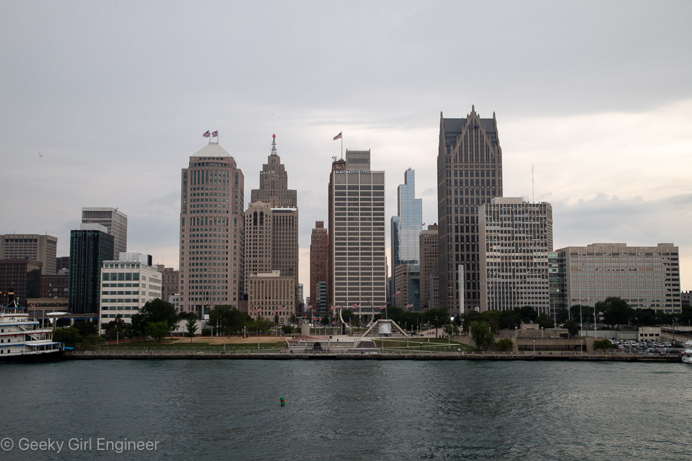
Downtown Detroit
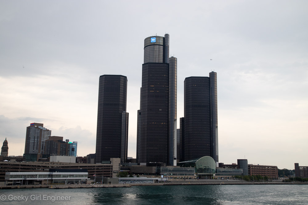
Renaissance Center
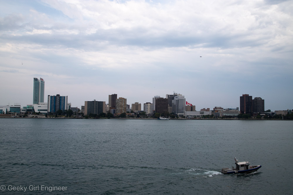
Windsor
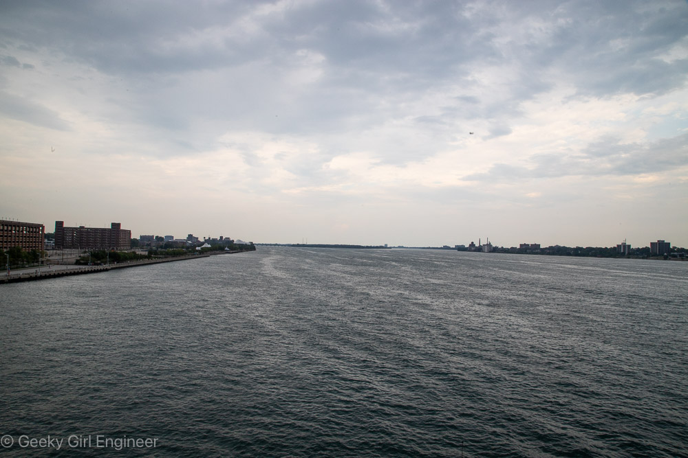
Detroit River looking north from downtown Detroit
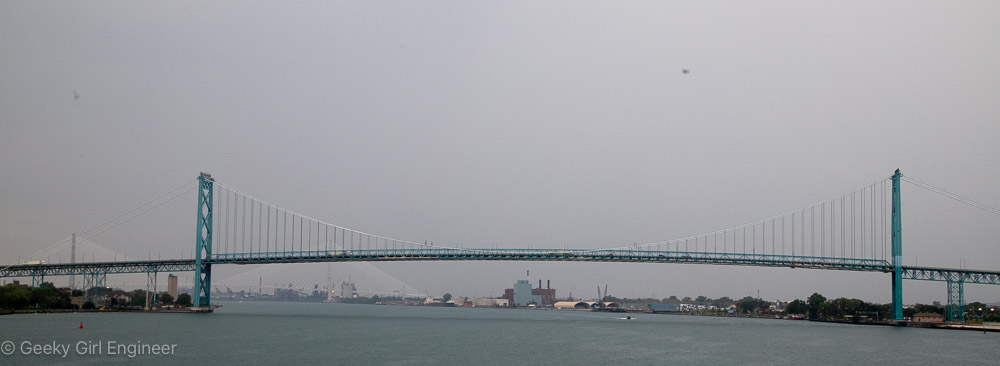
Ambassador Bridge
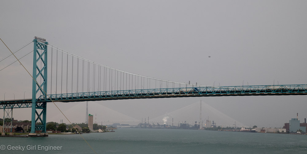
Ambassador Bridge with Gordie Howe International Bridge in background
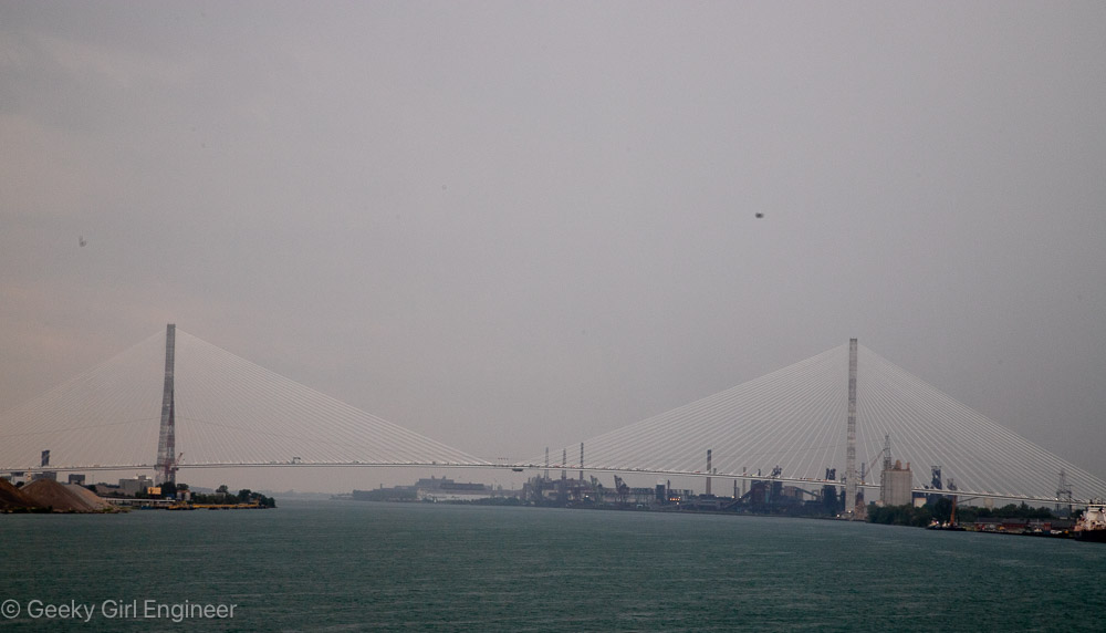
Gordie Howe International Bridge
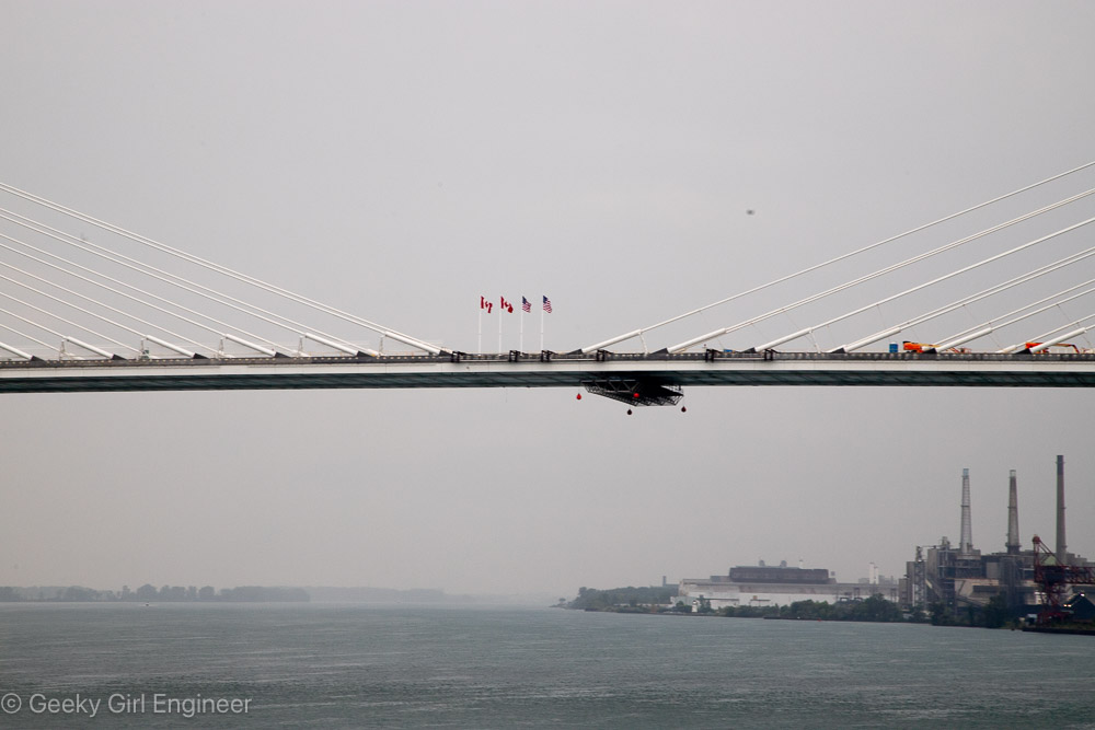
Gordie Howe International Bridge
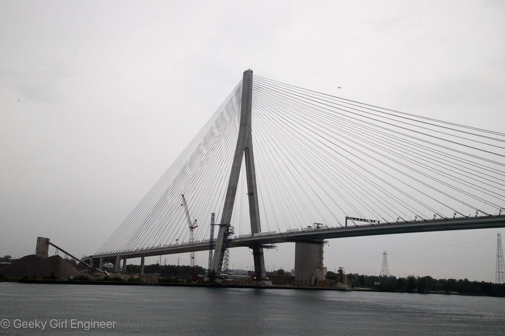
Gordie Howe International Bridge
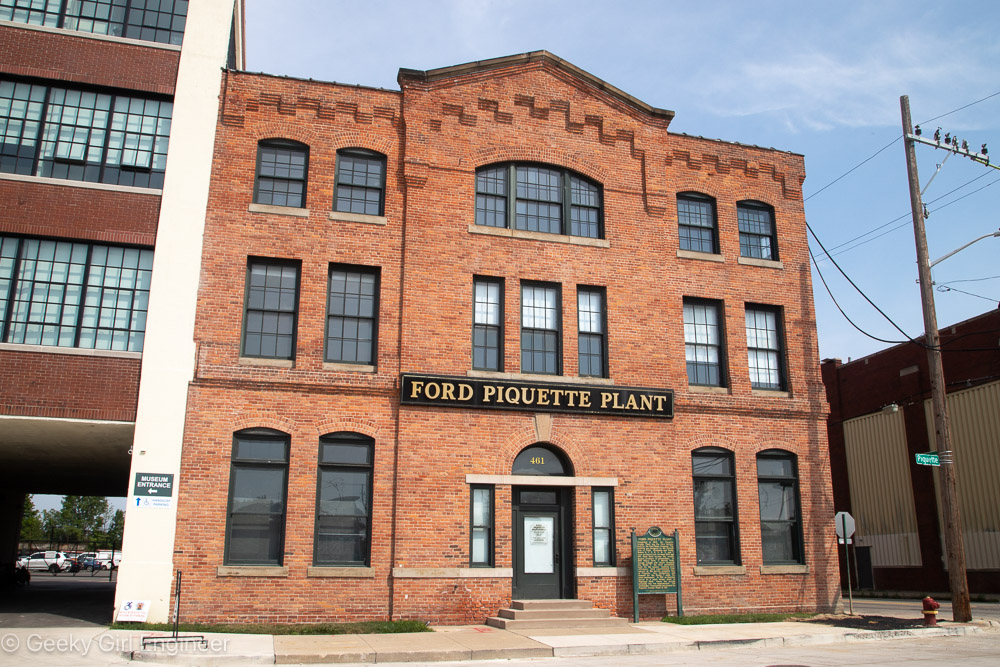
Ford Piquette Plant
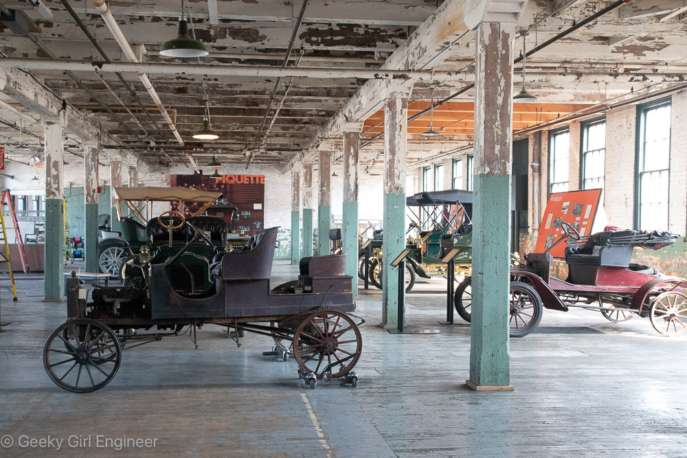
Today my cruise of the Great Lakes stopped in Detroit, and I took an excursion to the Ford Piquette Plant. It is a privately owned museum in the first building Henry Ford owned and operated as a plant. The first Model T’s were built at this plant. The museum has a great selection of early Ford Motors on exhibit including numerous Model T’s and earlier models, which is essentially the alphabet before the letter T. The museum has some old cars that were competitors of Ford Motors also. We had a wonderful tour guide who is a retired Ford Motors engineer and explained how these cars worked. His explanation of how car lights work, which I will not attempt to explain, quite frankly scared me. It just seemed like a disaster waiting to happen. One thing I found really interesting was the realization that the cars before the Model T had the steering wheel on the right side. Our guide explained that for a variety of reasons, the steering wheels were all initially on the right side, but with the Model T, the company rethought if it should be on the right and changed it to the left. For about ten years after that, Ford’s were built with the steering wheel on the left, but other companies put theirs on the right. Then at some point, everyone decided to standardize it on the left.
Among the examples of other company’s cars is where a couple designed for women, including the Detroit Electric 75 Brougham, shown below. The car was amazingly electric (considering we still don’t have that many electric cars), and the interior was quite unusual. The driver would sit in the back seat. According to our guide, it was rude for a high class lady to speak to the back of another lady’s head, so the front seat is turned to face the back seat, so all the women are facing each other.
In summary, it is a fascinating museum.
Ford Piquette Plant
Ford Piquette Plant
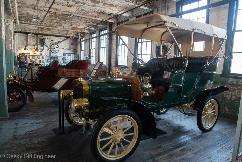
Ford Model B Tonneau
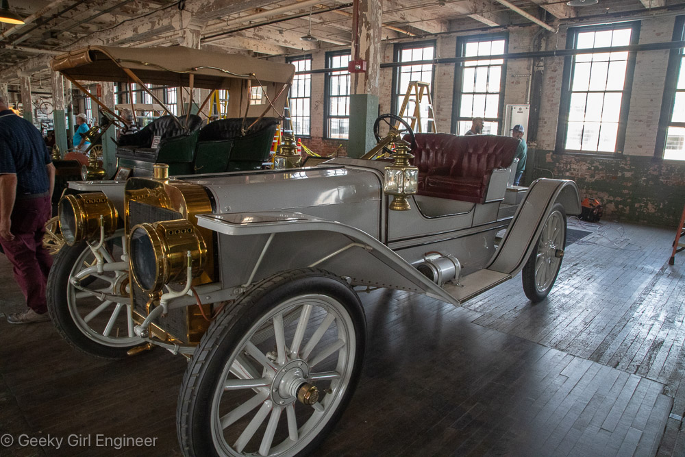
Ford Model (?)
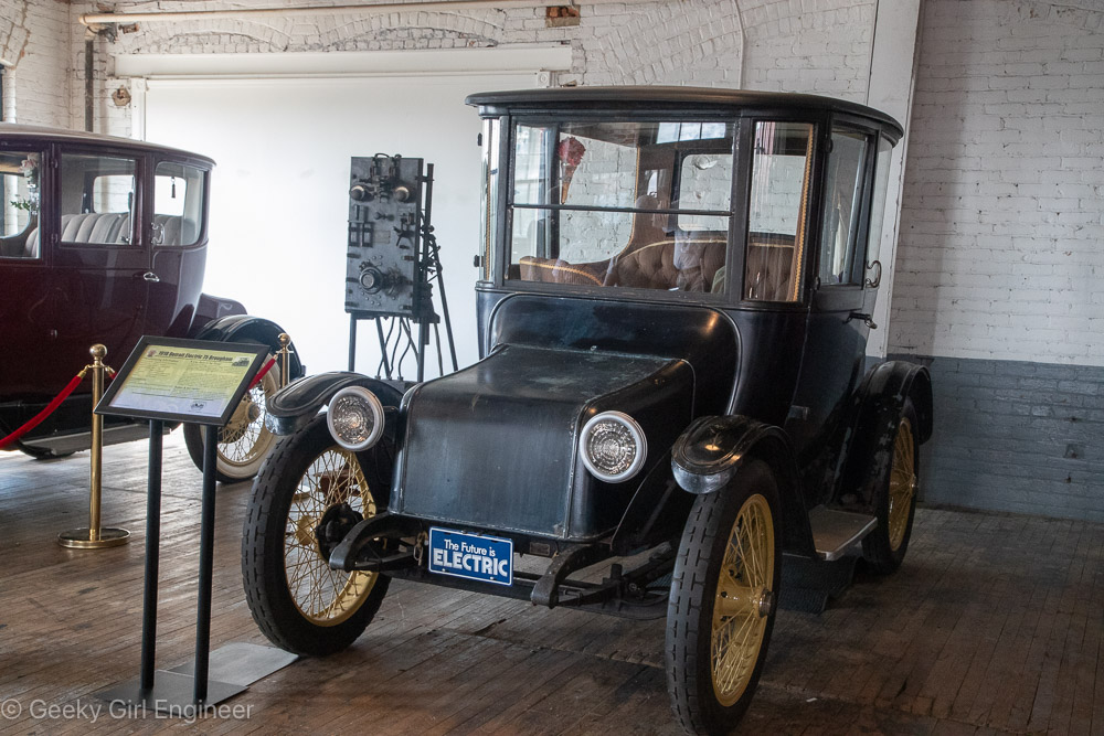
Detroit Electric 75 Brougham
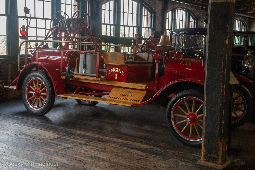
Ford Model T chemical fire truck
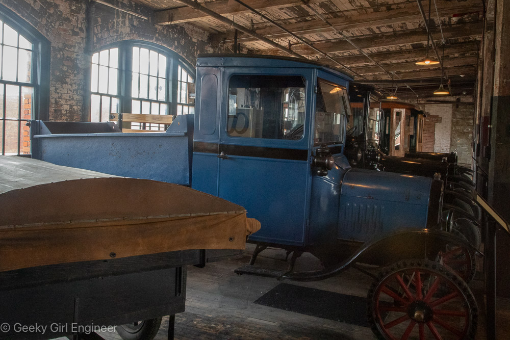
Ford Model T dump truck
Sault Ste. Marie
Today our cruise visited Sault Ste. Marie, which is the name of the city on both the Michigan, U.S. side and on the Ontario, Canada side. We docked though on the Canadian side in the St. Mary’s River on the Lake Huron side or elevation. I never actually went into town though. I boarded another boat with many other guests for a lock tour. We sailed through the Canadian lock into the Lake Superior side or elevation then made a giant semicircle to return to the Lake Huron elevation via the MacArthur Lock on the U.S. side. We then sailed downstream a little bit before returning to the dock. It was a really enjoyable cruise, and I always love locks. Besides going through the locks, I enjoyed seeing the steel plant on the Canadian side. I also was fascinated by the Sault Canal Emergency Swing Dam on the Canadian side. I had never heard of such a thing, so I appreciated learned about it.
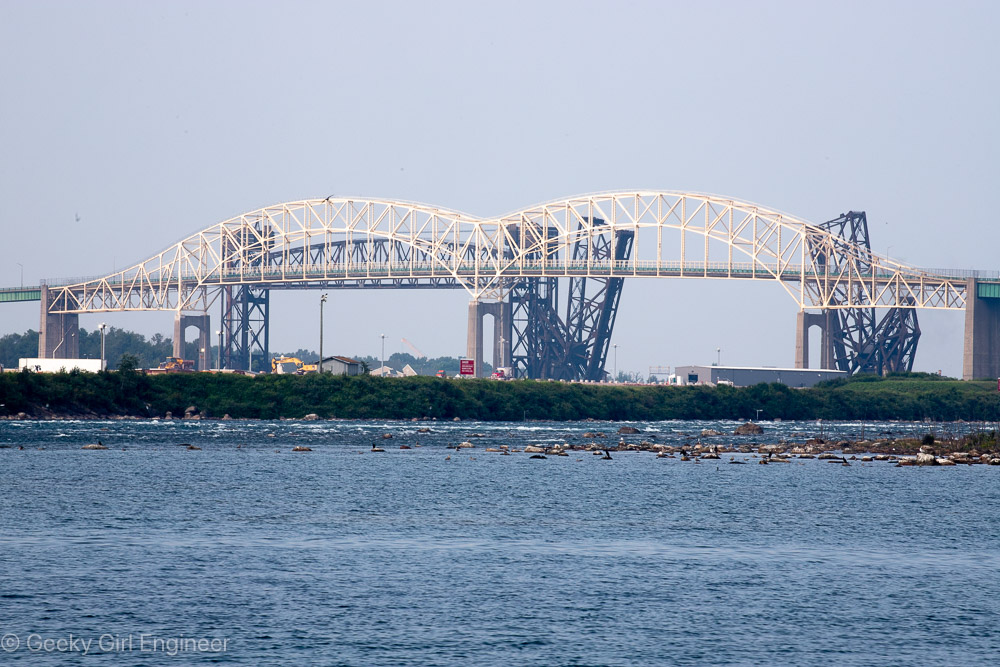
International Bridge with some of the St. Mary’s River rapids in front
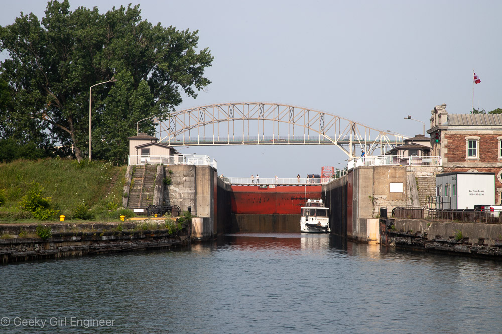
Canadian Lock
Sault Canal Emergency Swing Dam
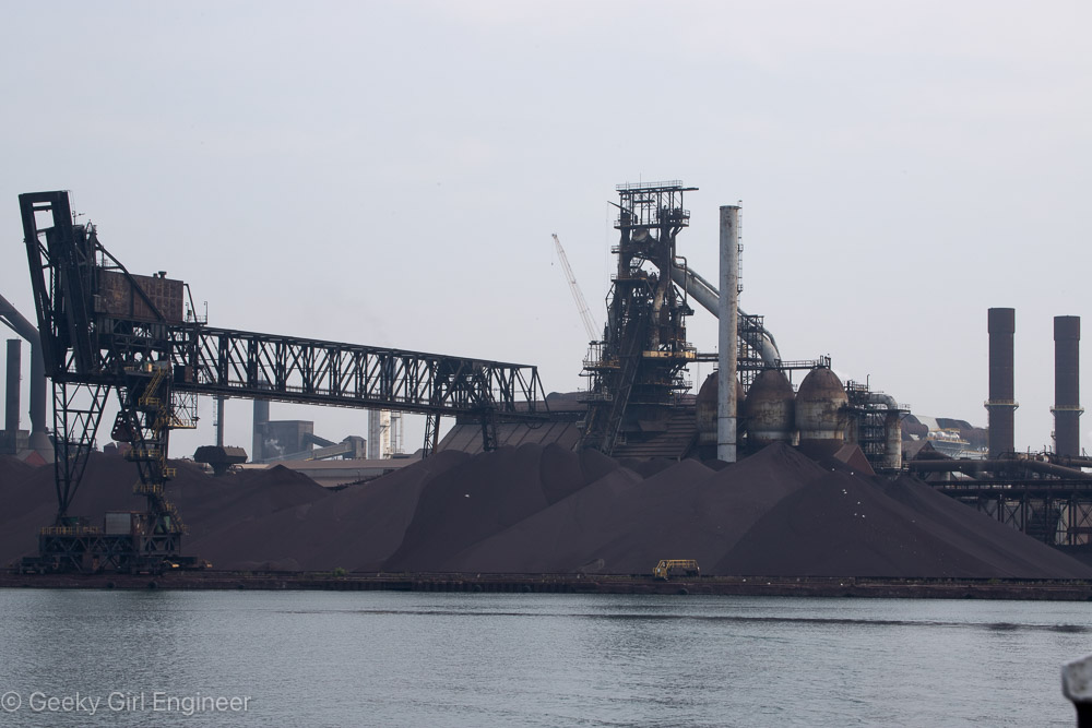
Algoma Steel
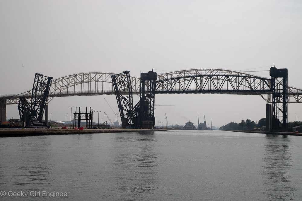
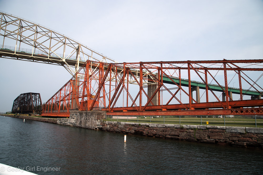
International Bridge and railroad bridge
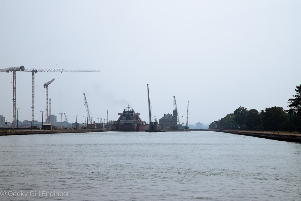
U.S. Lock with construction of new lock visible on left
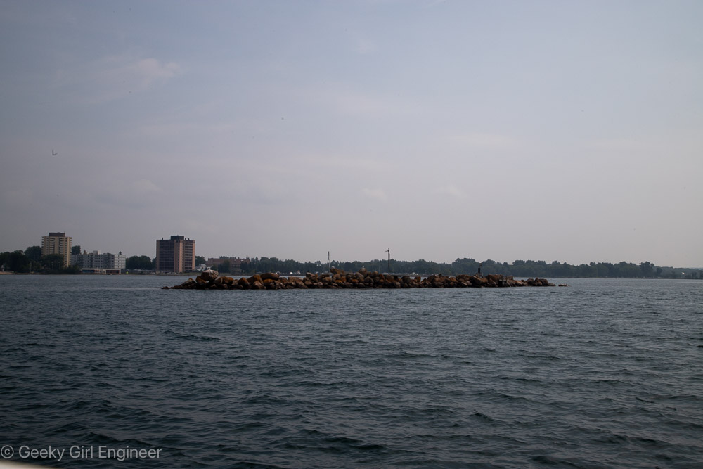
Rock pile indicating Canada/U.S. border in St. Mary’s River
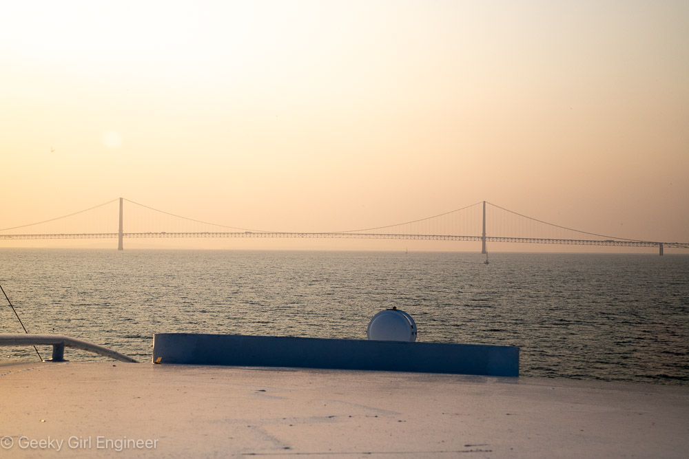
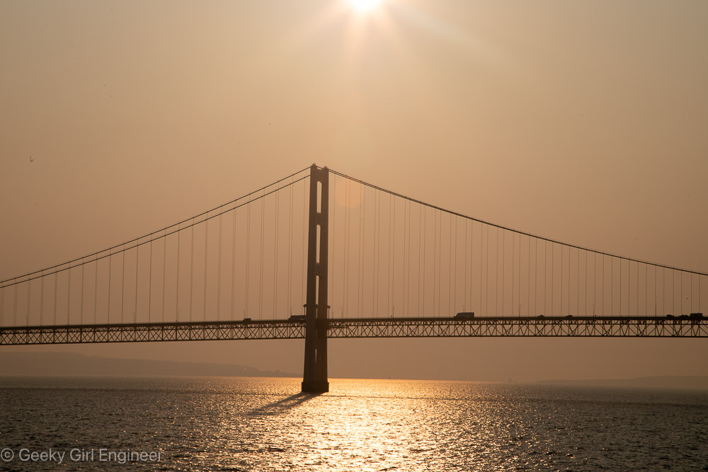
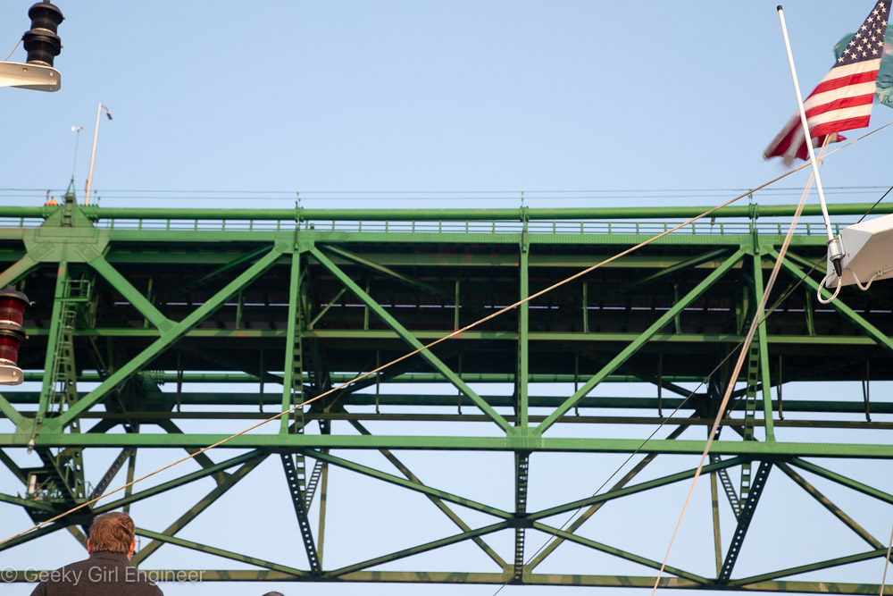
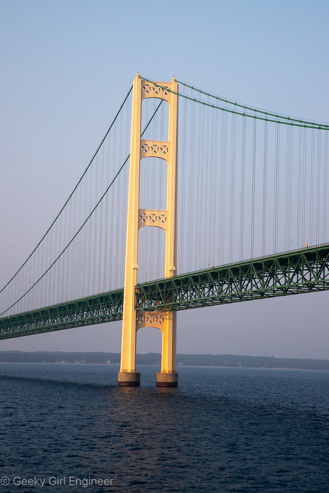
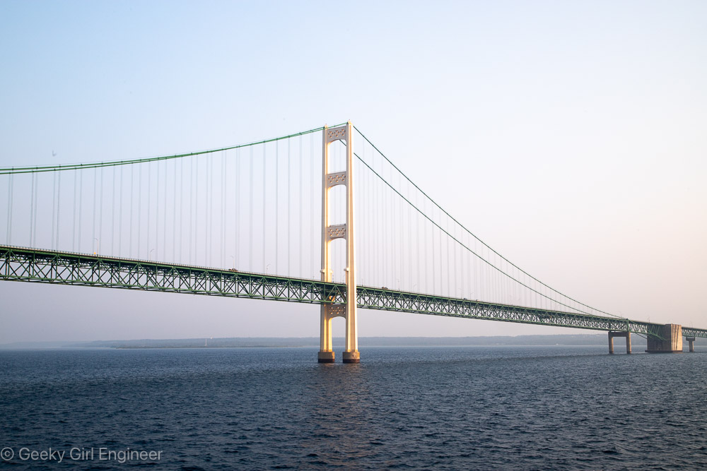
Mackinac Bridge
Today my cruise of the Great Lakes arrived at Mackinac Island. On the way there, shortly after sunrise, we passed under the Mackinac Bridge. It is a gorgeous suspension bridge with green metal work. They clearly do maintenance on it as it was built in 1957, and it looks great. Naturally half the passengers on my cruise were outside on deck to watch us pass under the bridge. I was definitely among them. Below are some photos of the bridge.
Mackinac Bridge
Mackinac Bridge
Mackinac Bridge
Mackinac Bridge
Mackinac Bridge
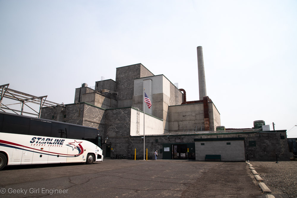
Hanford Reactor B
Yesterday I went on what is pretty much a nerd tour of Hanford Reactor B. Hanford is the Department of Energy facility where they made plutonium to make nuclear bombs, and Reactor B was the first reactor built during World War II to make plutonium. It is now a National Historic Landmark. The tour included a long bus ride to the site, which gives you a better understanding of just how big Hanford is. The tour then includes several hours to wander around the building, and several presentations by docents. I still can’t quite get over the fact that the public can tour a building where they used to make plutonium, which is rather radioactive and toxic.
The science and engineering behind the facility was impressive, and I also enjoyed looking at 1940s era technology and signage. I don’t if it was that era, or the facility, or what, but there were some fun signs all over the place. There were also some hidden historical signs, like all the clocks were stopped at 10:48, which was time on the night of September 26, 1944 when the reactor achieved fission for the first time. I don’t know why, but I was amused that almost every room had a “broom” station, which were pegs on the wall where a broom and dustpan were hung. I think I only saw one room where there was actually a broom in its proper station. I guess they do less sweeping now, or they have moved onto vacuum technology.
I really appreciated that you could wander around and spend your time looking at everything. Most of the areas have decent signage to indicate what you are looking at, although the engineer that I am, I would prefer perhaps a bit more detail. My one criticism of the tour was that they completed glossed over the amount of environmental contamination created at Hanford. In an intro video we watched before taking the tour, they briefly mention that waste was buried to be dealt with later. The docent at one point said they are cleaning up the site, which is an understatement. I know enough about the site to feel like they just didn’t want to admit the contamination they caused. Signs of remediation are present in the building. There were plenty of pipes that obviously had asbestos, and the pipes had clearly been abated to encapsulate the asbestos, so it would not become airborne and thus a hazard. There were dosimeters on the walls everywhere, which were clearly been analyzed frequently.
Hanford Reactor B
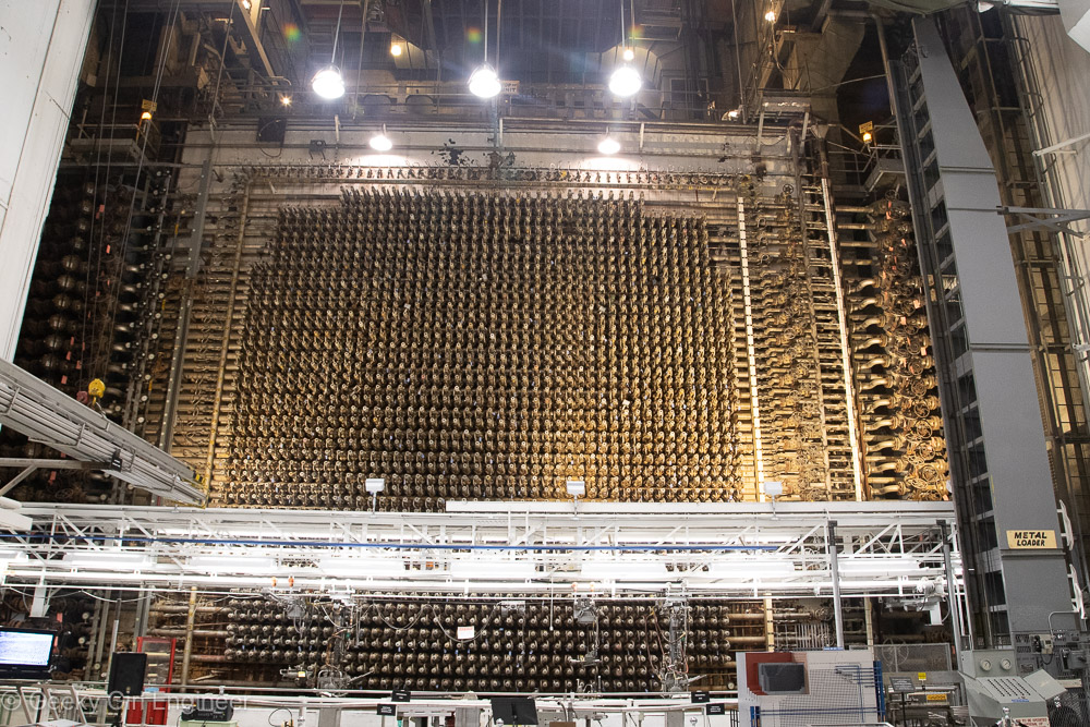
Front Face where fuel rods were loaded into reactor, which is behind the front face
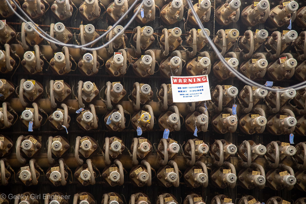
Warning Do Not Introduce Heat Source into any opening in reactor unit
Front face close up fittings
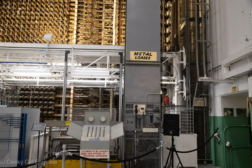
For security reasons, it was called the metal loader instead of uranium loader
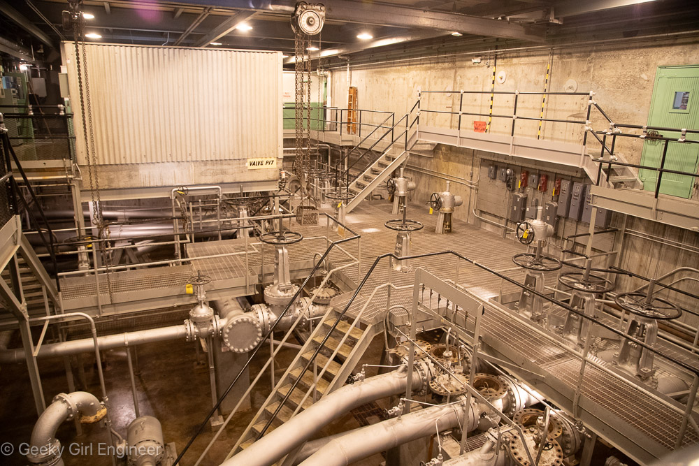
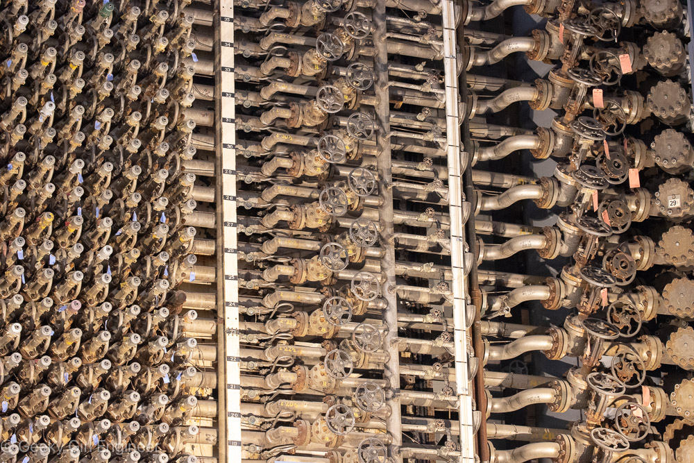
Valve Pit Room; notice in lower right, tops have been removed from access openings; tops were removed at Russian inspectors’ request to prove no water was going through pipes as part of treaty to reduce nuclear weapons
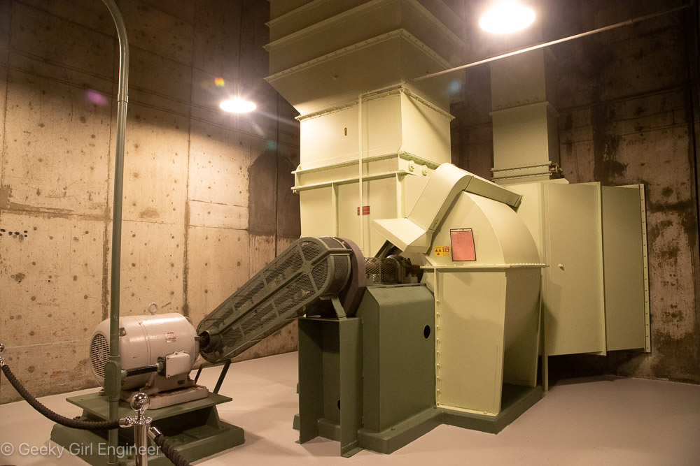
Exhaust Fan
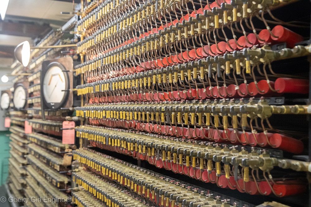
Wall of something in control room
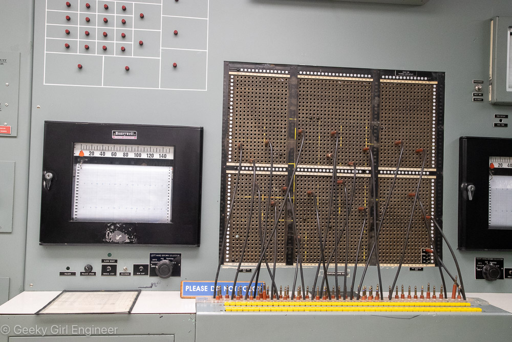
Control Room, telephone switchboard equipment was used to monitoring equipment
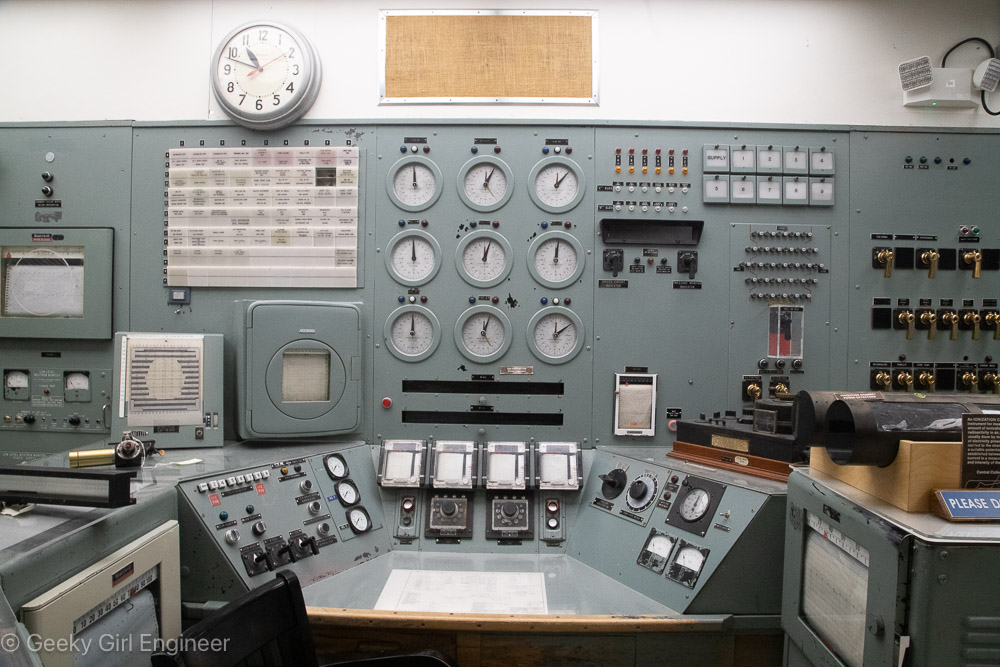
Control Room where operator sat
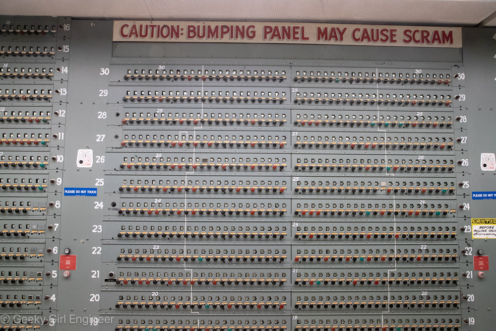
Control room board with warning “Caution: bumping panel may cause scram”
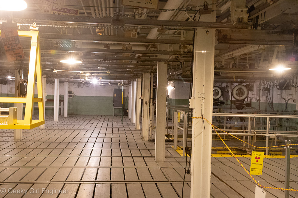
Fuel Storage Basin, there used to be water underneath the wooden boards where the used fuel was stored temporarily
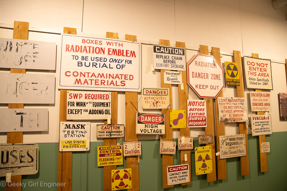
Wall of old signs
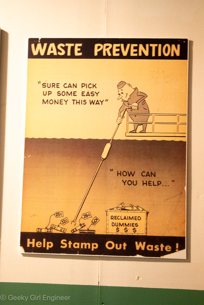
Old sign (my favorite)
Stair Pulley System
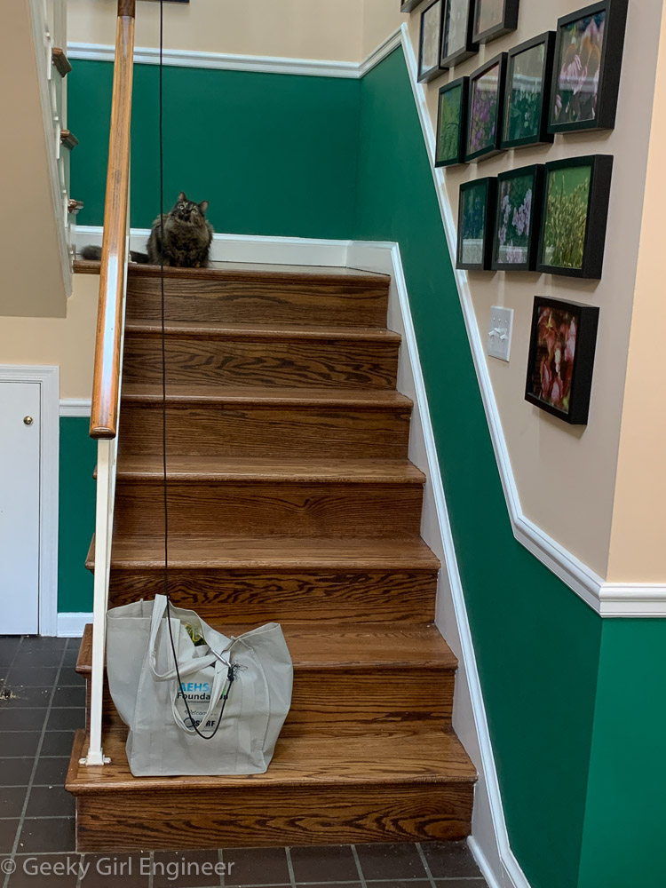
Surgery for scoliosis was two months ago now, and I am still recovering. My ability to walk is improving slowly as my body adjusts to the new spinal arrangement. I have a limp that is going to take time to fix. I can climb and descend stairs, but I have to hold onto the railing with one hand, and it is really better if my other hand is at least touching the other side. The main part of my house is on the second floor, so I have had to figure out how to get things up and down the stairs if I want to live on my own.
There are a couple of solutions, but I am engineer, so naturally I installed a small pulley system to transport items up and down the stairs. I think it is the most efficient solution. I bought a small pulley with accompany hook and rope, and I installed it on the railing overlooking the stairs. My stairs have a landing at the halfway point where they change directions, so that made the pulley system really easy to install and allow for a straight path for items to ascend and descend.
Note that my cats oversee all operations of the pulley.
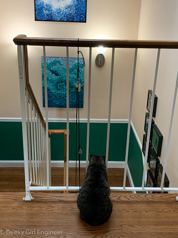
Pulley system installed on stair railing
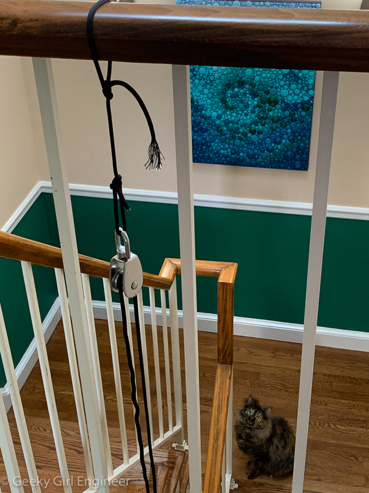
Pulley used
Groceries loaded onto hook to lift to second floor

Groceries pulled to the second floor
Montreal Museum of Archaeology and History
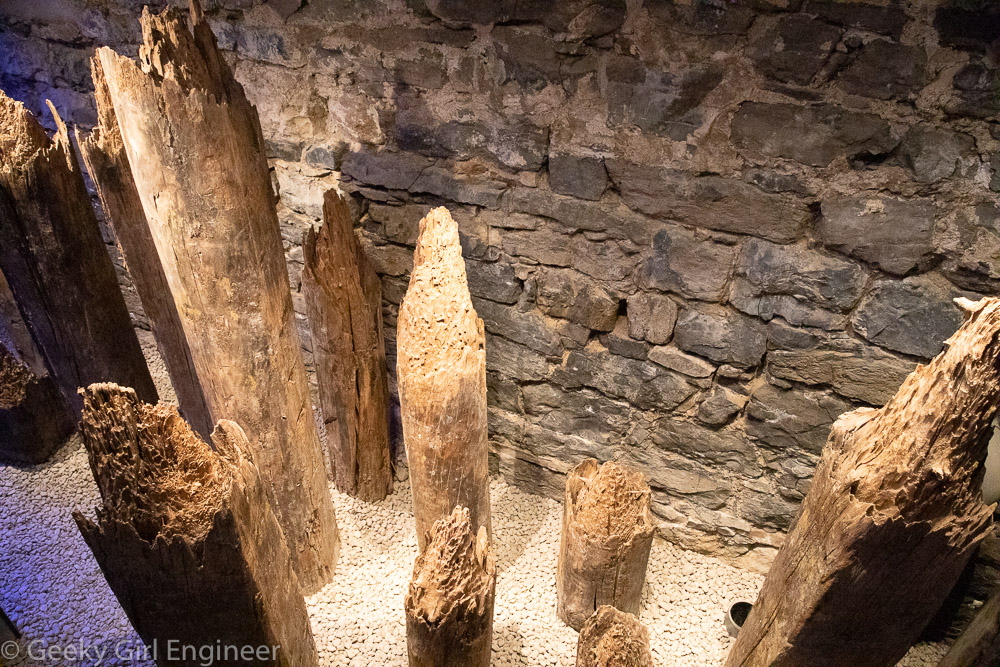
I am currently in Montreal for the second time. The first trip was short, but I visited the Montreal Museum of Archaeology and History, and I really liked it. This trip is also short, but I had time to visit the museum again. Most of the museum is underground in an archeological site of old Montreal. You can walk around the stone walls of buildings that used to stand on the site. The museum does a really nice job of projecting onto the ruins lines and text, so you can understand at what you are looking. They also have stairs, so you can climb on top of ruins and look down onto them without damaging them. Further, in some areas, they have lights hanging from the ceiling that light up during an audio explanation of what is at the site, so the lights emphasize what the used to be at the site based on the ruins.
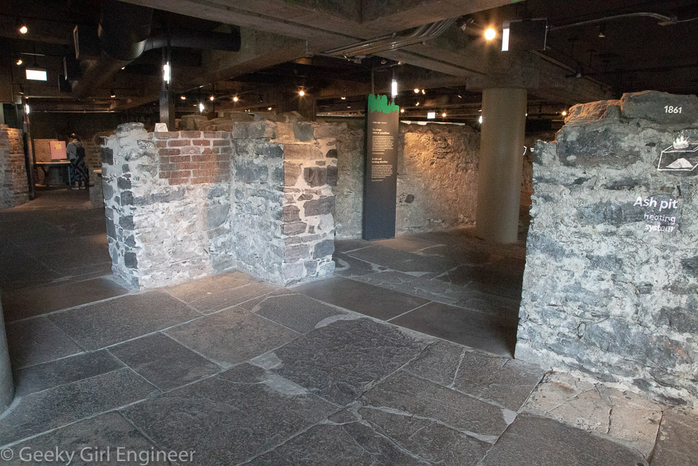
Floor and walls of the former Royal Insurance building
Foundation of the former Royal Insurance building

Foundation of the former Royal Insurance building with a projection showing the inverted arch of the foundation
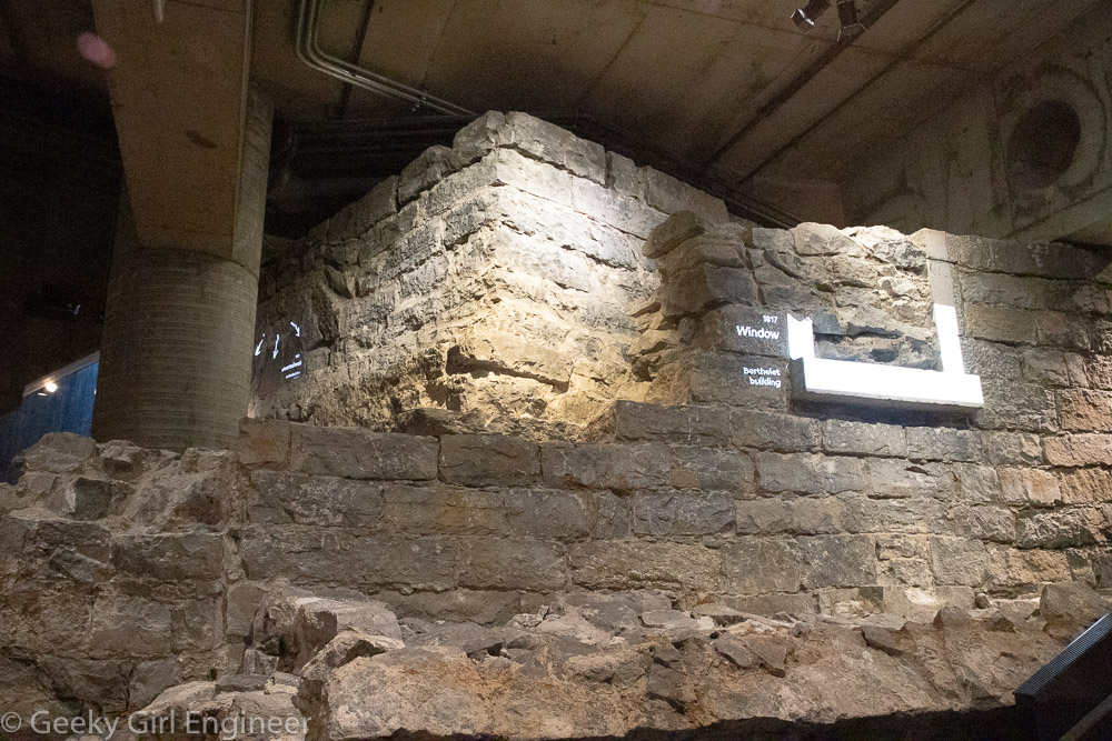
Foundation of the former Royal Insurance building and projection showing window of Berthelet building
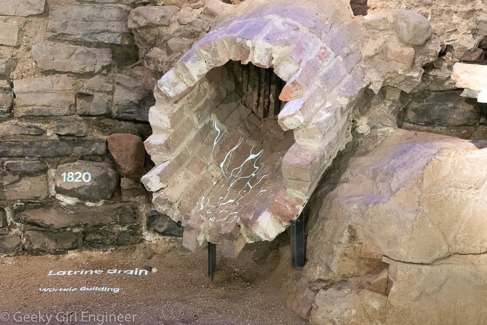
Old latrine drain with projection indicating how water ran
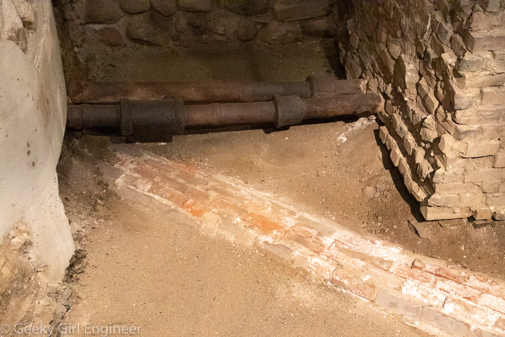
Old pipes in archeological site
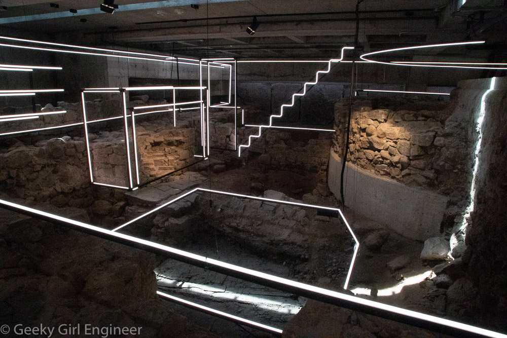
Exhibit lights suspended over archeological site to indicate what is present
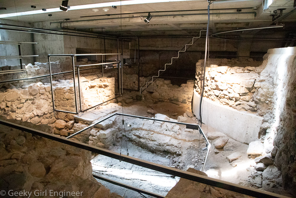
Exhibit lights suspended over archeological site to indicate what is present; lights are turned off in this photograph so site is detail can be seen
Powerhouse Arts
Powerhouse Arts is a new arts and fabrication studio and rental venue housed in a renovated power station in Brooklyn, New York, and they hosted an open house today through Open House New York.The building has been completed renovated, but they have left some of the graffiti on the walls from when the place was essentially abandoned, and squatters lived there. The facility now houses several different art studio areas like a ceramics area and print shop. It also has huge spaces that can be rented. The facility is right on the Gowanus Canal, and it has wonderful views of Brooklyn and Manhattan.
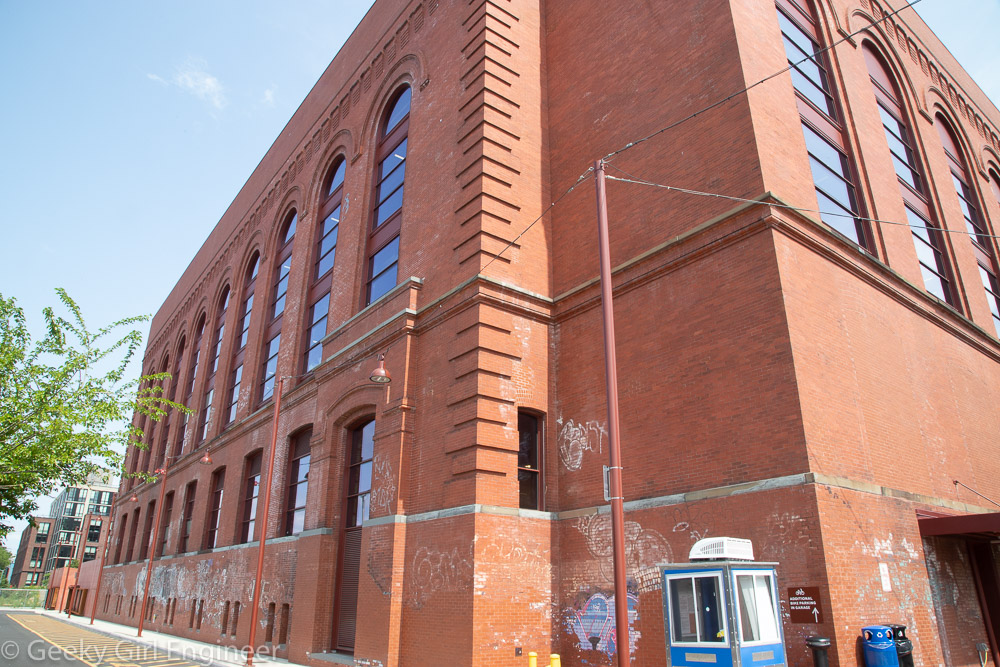
Powerhouse Arts located in an old power station
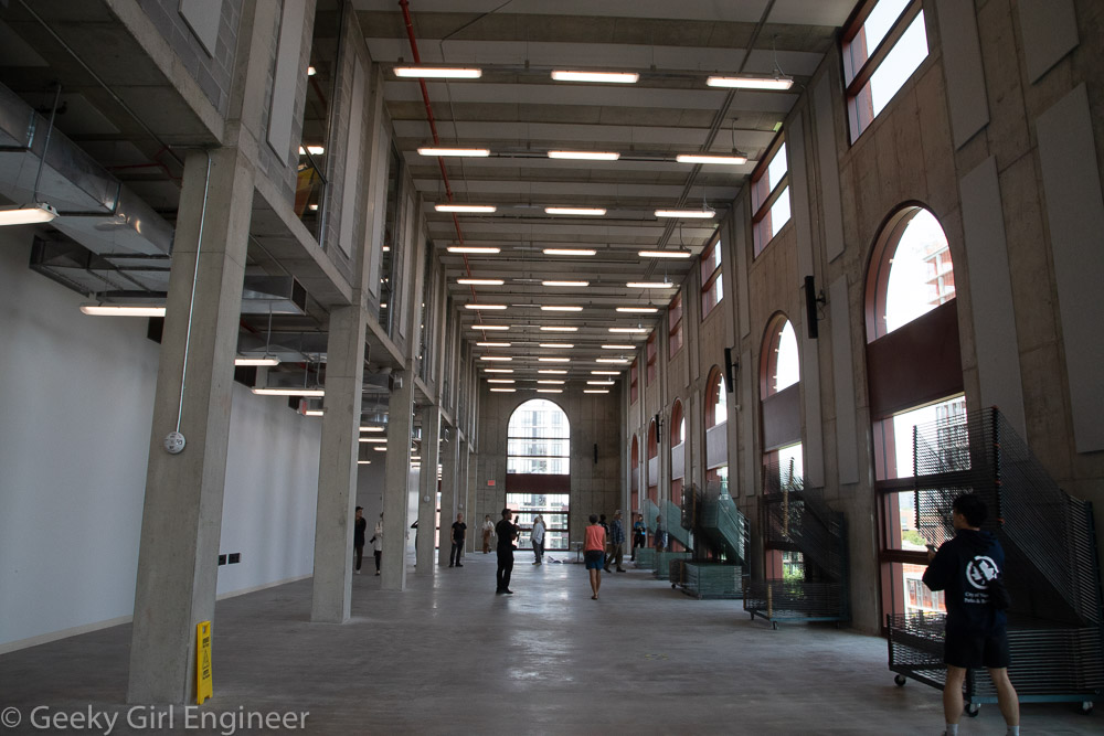
Former steam production area
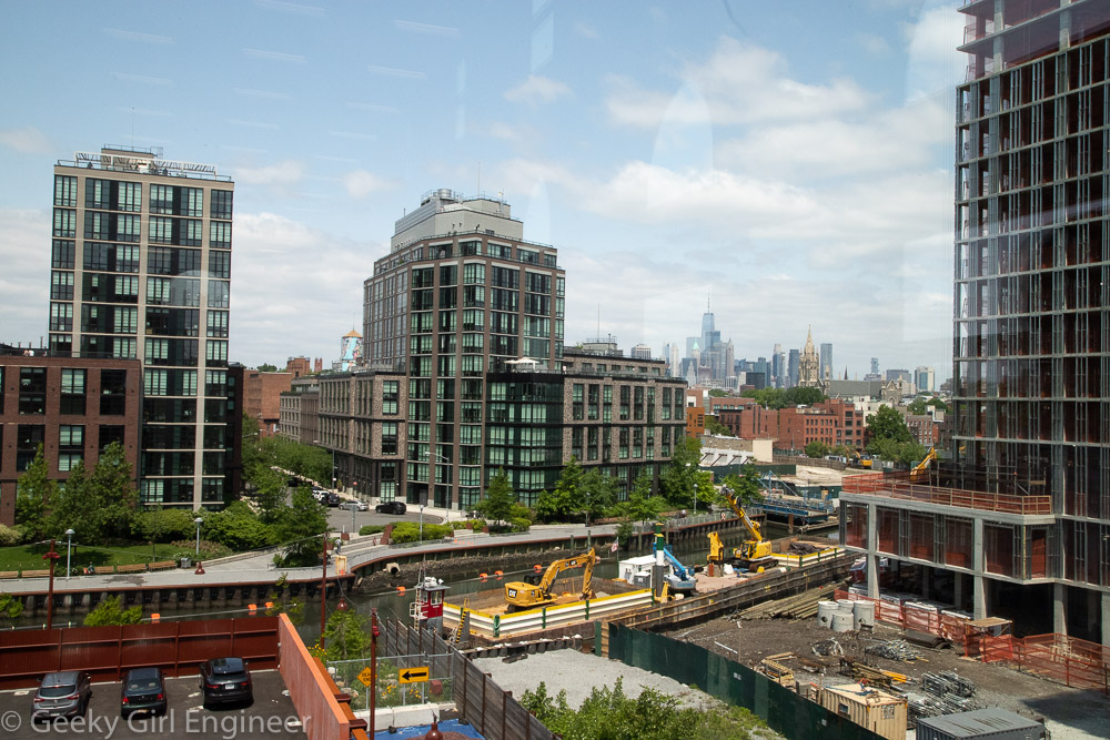
Downtown Manhattan and the Gowanus Canal can be seen
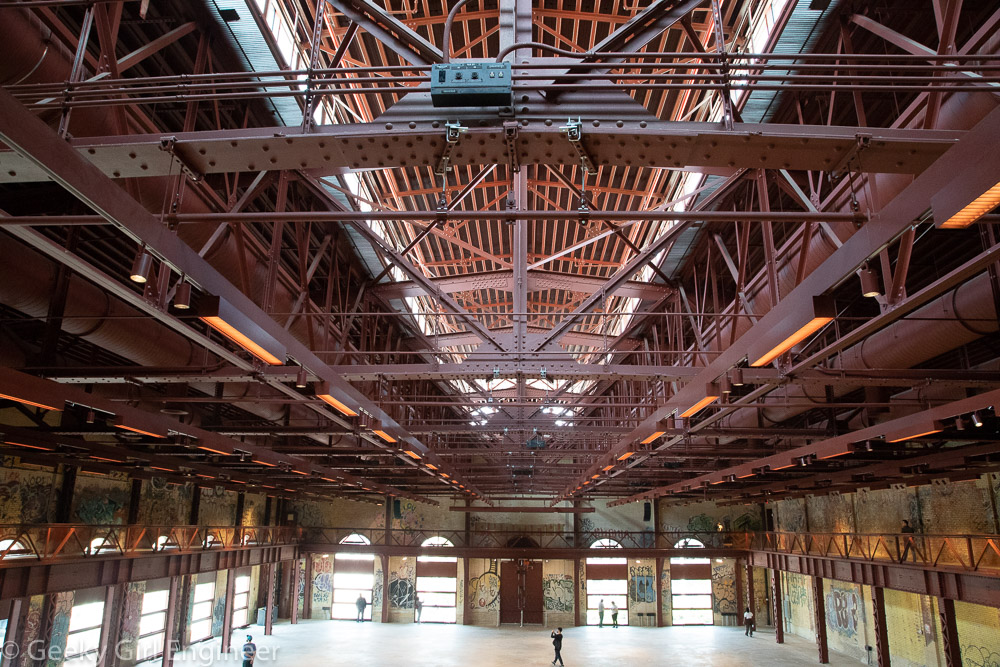
Former turbine hall
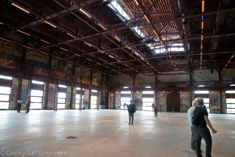
Former turbine hall
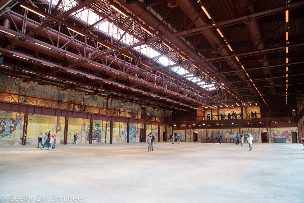
Former turbine hall
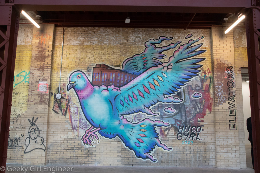
Newly commissioned artwork in the Grand Hall
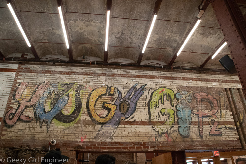
Graffitti in entrance hall
Historic Richmond Town, Staten Island
Last week, I went for a guided walk with NYC H2O of historic Richmond Town, Staten Island to hear about the history there, in particular how the water affected the history. Historic Richmond Town is a neat little area as it is a park of historic buildings. If I read the information correctly, some of them were moved there to be part of the preservation area. There is a mill there that operated off the creek that runs by the area. Nearby and also part of our walk is Brookfield Park, which is a former landfill. From an environmental engineering perspective, it is nice to see what the landfill has become. Although it is not clear if remediation is ongoing, as the landfill was rather old, so it is not clear what engineering, if any, went into it.
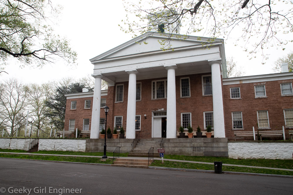
Third County Courthouse
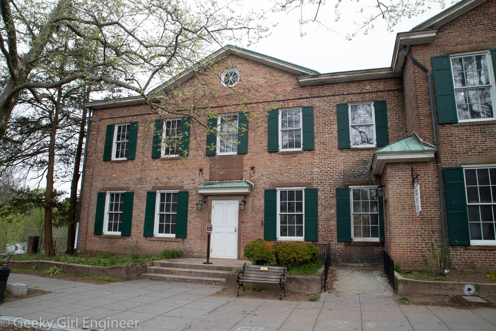
Former County Clerk’s and Surrogate’s Office

Tin Shop
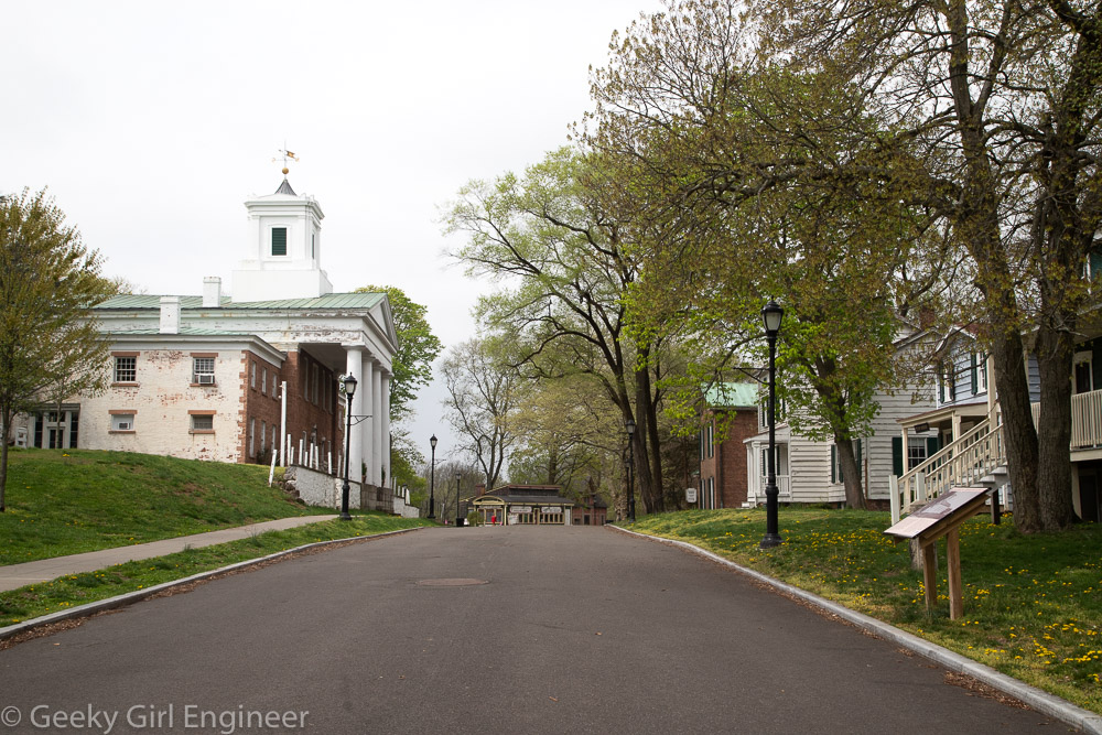
Historic Richmond Town
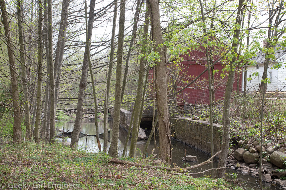
Old Mill
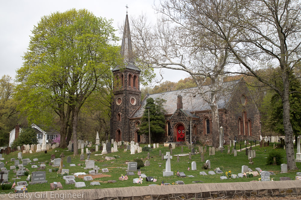
St. Andrew’s Church

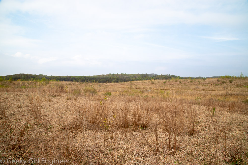
Brookfield Park
Brookfield Park