I use Google Maps all the time. It is really convenient, and for the most part it works well with various types of travel modes. I probably use it more for walking routes and public transportation than I do for driving. It is far from perfect, and it has a truly annoying habit of refusing to show public transport routes only without cars. It has an annoying habit of telling me to take a car to a subway station, which is just plain silly. You can tell it to give you a no car option, but you have to select that option every single time you use it on the phone. Still, it is useful.
There is a guided walk on Staten Island that I am interested in joining, so I used Google Maps to determine how I could get there on public transportation. Whenever I am in New York City, I always stay in the Penn Station area, so I mapped how to get to the starting point from Penn Station. Below is the route focusing on the Staten Island portion.
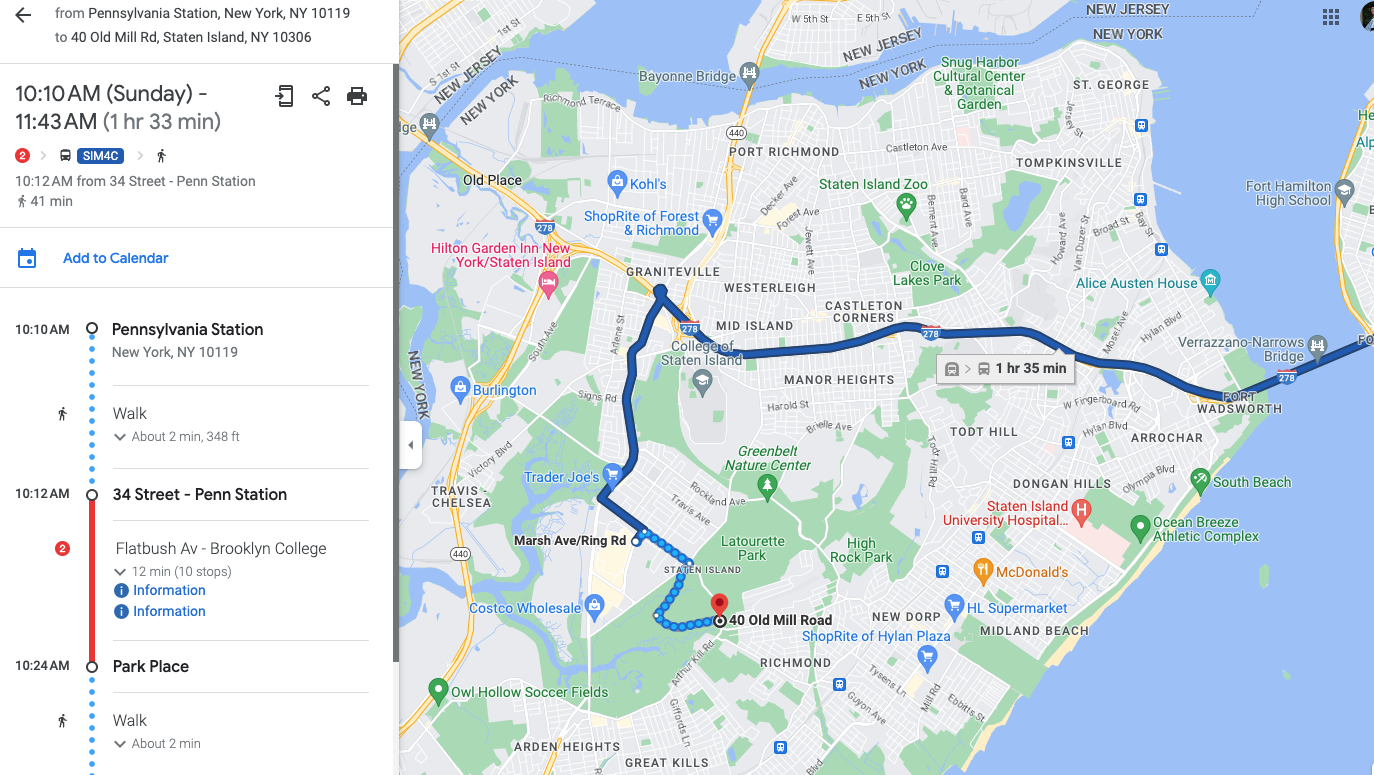
Google Maps route from Penn Station using public transportation
The route involves quite a bit of walking from the final bus stop to the walking tour location, and it did not seem like the quickest route. I noticed that the Staten Island Railway (SIR) has a station not too far from the tour location, and it looks like one of the stations was a shorter route, so I had Google route me from the ferry terminal, which is the terminal for the SIR.
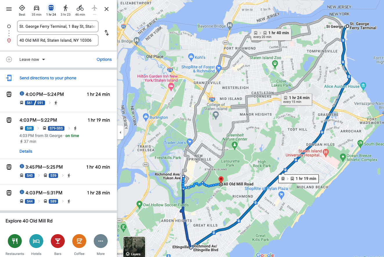
Google Maps route using SIR
Google Maps obliged and routed me via SIR, but the route seemed even more circuitous. It routes me three stops past the closest one to a bus. It then takes me on the scenic route to the walking tour location. I tried then to get it to route me from the closest SIR station to tour location.
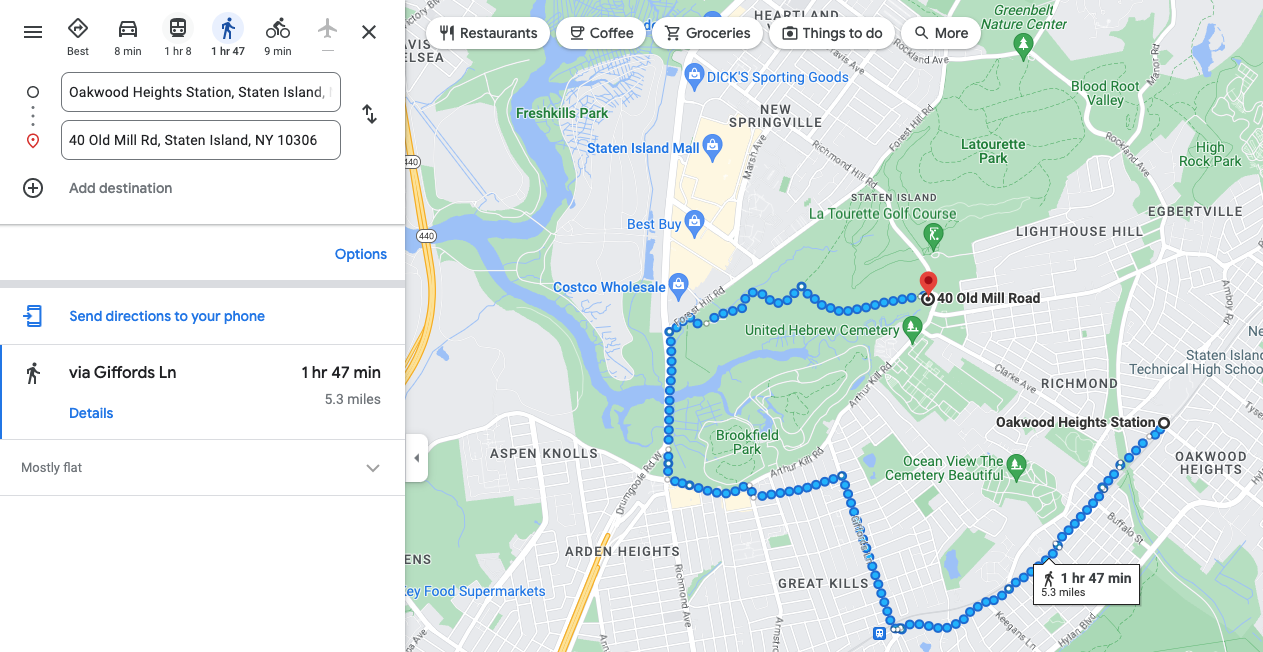
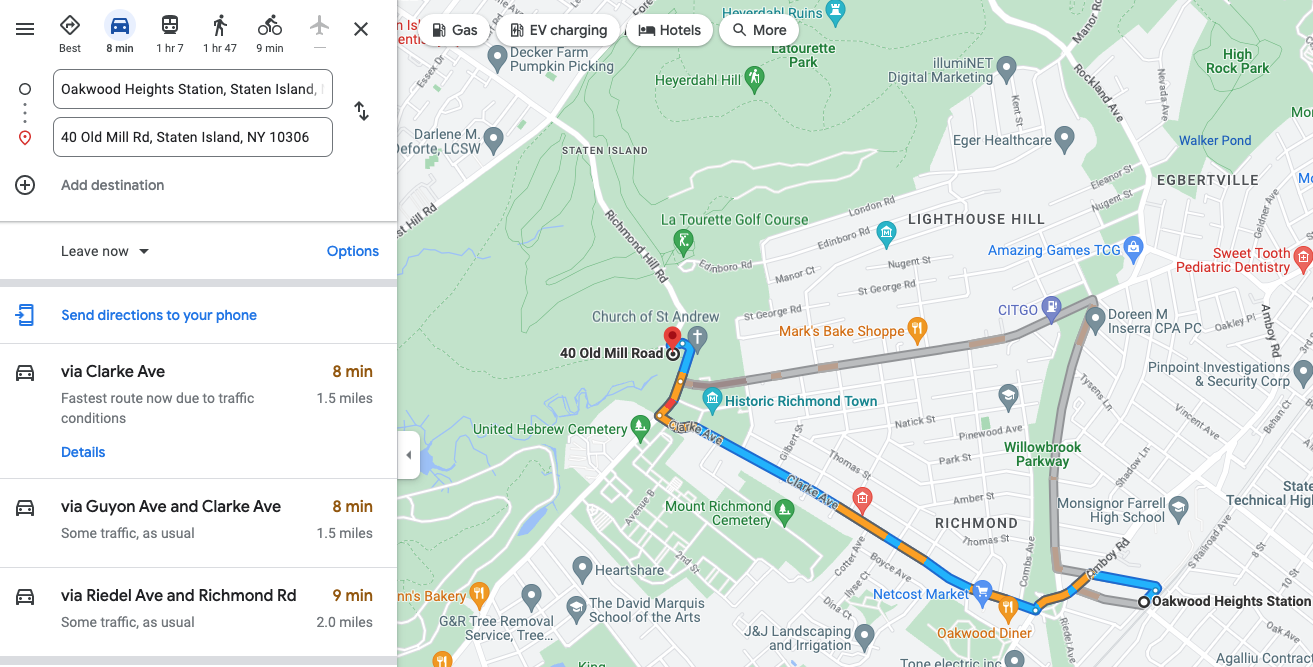
Google Maps route from Oakwood Heights Station
Google Maps really wants me to take a walking tour of Staten Island, I guess. This is clearly not the most direct route. I then tried to force it to take me on the more direct route by moving the route. Things just got silly at that point.
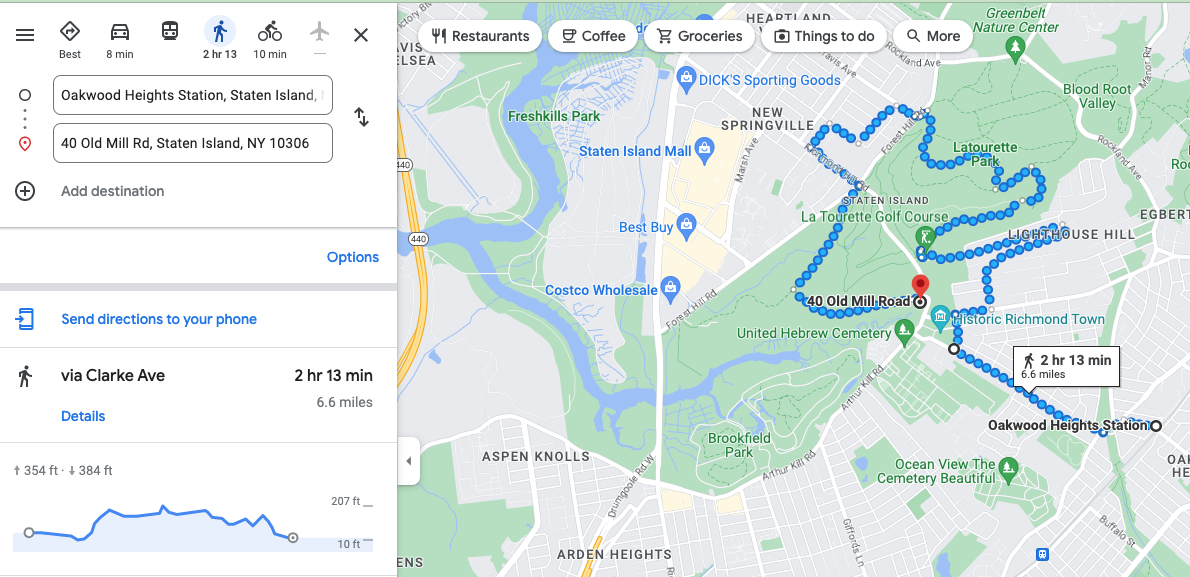
Google Maps route from Oakwood Heights Station after I tried to steer it to a more direct route
This clearly is an absurd route, and it also seems to be taking me on a tour of a golf course, which is probably not an actual walking route. I thought perhaps I was missing something, like a road that was not open or something, so I had it route me from the same starting to ending point but in a car.
Auto route
What do you know, it knows there is a direct route, but it just refuses to believe you can walk it. I played with it for quite a bit. I also used street view to try to figure out why it would not let me walk on the same street it would let me drive.
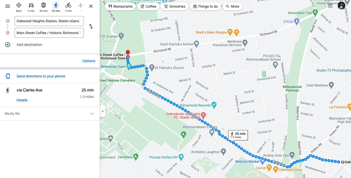
Google Maps route from Oakwood Heights Station to coffee shop
After much experimenting, I finally found that it would give me a direct walking route to a nearby coffee shop. I still don’t know why Google Maps will not let me walk directly on to where I want to walk. My best guess is that part of the walk does not have sidewalks. The route definitely does not involve some sort of freeway or similar where it would be dangerous for a pedestrian. However, the answer can’t be lack of sidewalks because a part of the route above does not have sidewalks either based on Google street view. Thus, I don’t know.
TL/DR: AI is not taking over the world yet, at least for navigation.