Clapham South: Subterranean Shelter Tour

Last time I visited London, I found out that London Transport Museum offers Hidden London tours, so I signed up for one. It was fantastic, and luckily they were offering another tour while I was here again. This time, they offered a tour of Clapham South subterranean shelter that was built during World War II. When the Germans bombed London during 1940-1941, some people took shelter in London Underground stations, which the transport authorities didn’t really want them to do. The government then asked them to build proper shelters for people. The transport authorities had previously had plans for an express train to run underneath the Northern Underground line, so they used parts of those plans to plan ten shelters to each shelter 10,000 people underneath Northern line stations. Only eight stations were built though, and London Transport Museum now owns one of them, the one that that was built under Clapham South station.

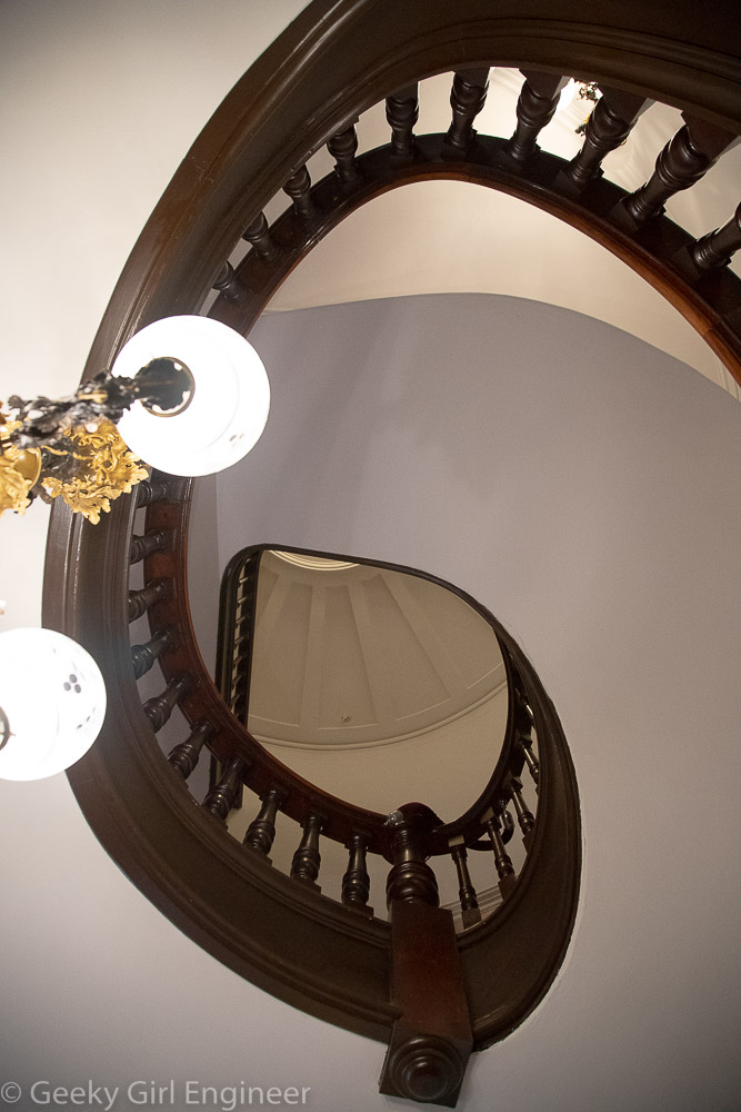
The shelter is 11 stories underground and has over a mile of subterranean passageways. It is accessed via a spiral staircase with many, many steps. [We had to walk down them and then back up when the tour was over.] The shelters were built just like London Underground tunnels with the idea that after they were no longer needed as shelters, they could be used to start construction of the previously mentioned express lines. That never happened though. The tunnels were all divided in half horizontally, so that they formed double-decker shelters. Each level was then divided into eight sections all given names of historical people, with rows and rows of beds. People would be assigned a bed and told which section and which bed number was theirs. The shelter were not finished before the end of the Blitz, but they were used later when V-1 and V-2 bombs hit London. Government propaganda advertised them as “luxury tunnels” with “comfortable canteens.” Those terms are kind of relative. The beds were small and really close together. They did have lavatories, but the toilets consisted of buckets with a possible seat. The buckets were emptied into a tank. This is my favorite part (especially as an engineer), when the tank needed to be emptied, a valve was turned to add compressed air, and another valve was turned to allow the compressed air to (hopefully) shoot the waste up into the sewer tunnels above. However, the shelters certainly kept people safe from bombs. Some people who stayed there had no other place to go as their home was destroyed.

After World War II, they continued to be used at different times. In 1951, there was a huge festival in London, and the shelter was opened as “Festival Hotel.” Also, Caribbean migrants arriving on the Empire Windrush stayed there temporarily. Finally U.S. troops stayed there in the 1950s. Some of the shelter were later used for archiving material.

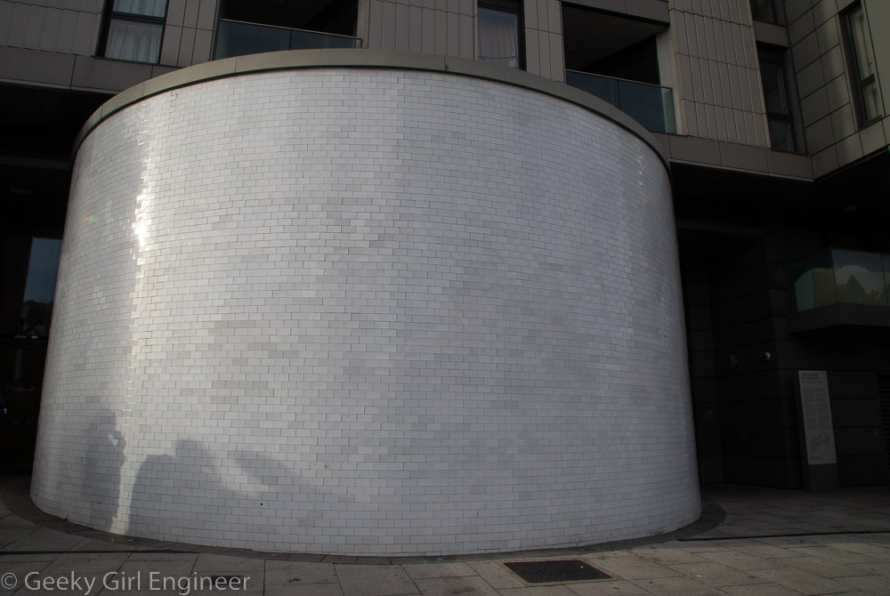
Exterior of entrance with spiral staircase inside

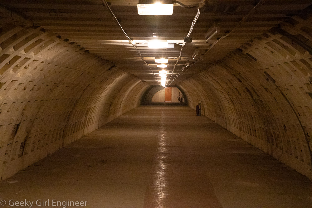
Clapham South Tunnel/Shelter

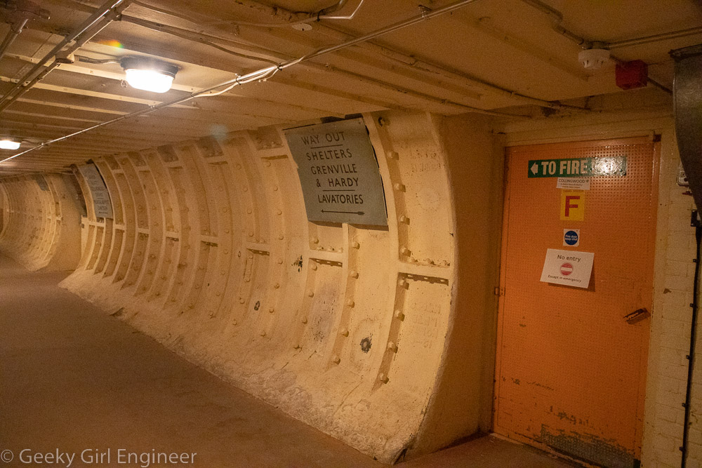
Sign with directions to exit, other shelters, and lavatories
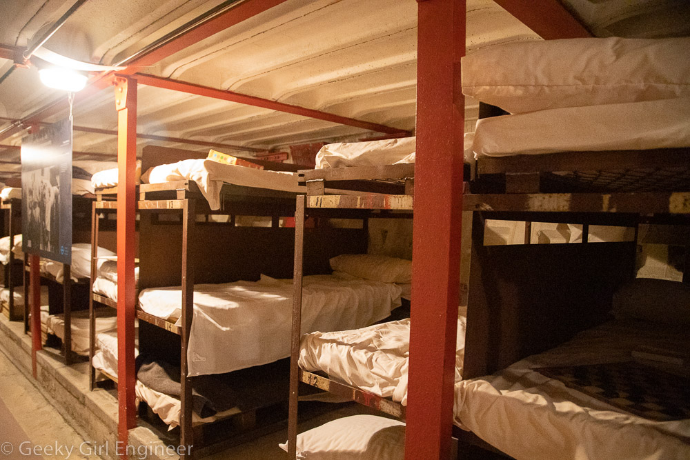
Shelter beds

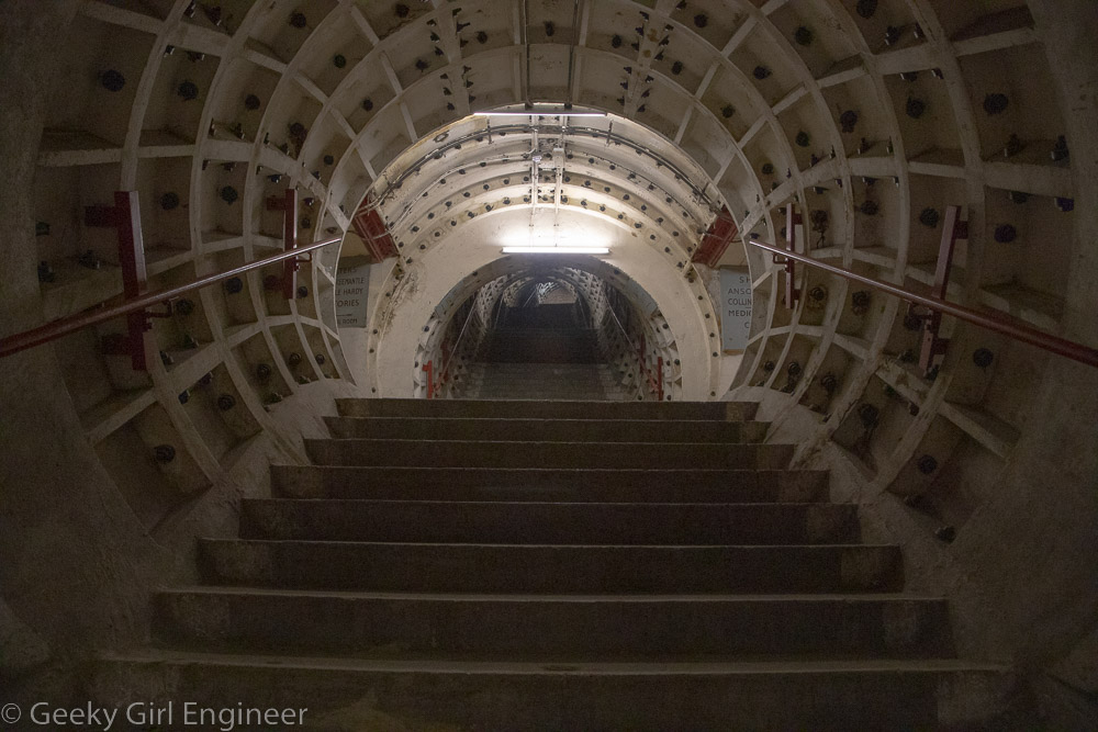
Stairs to Underground station
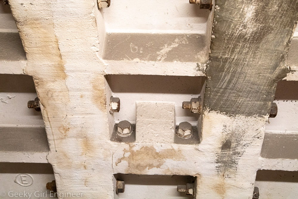
Tunnel walls

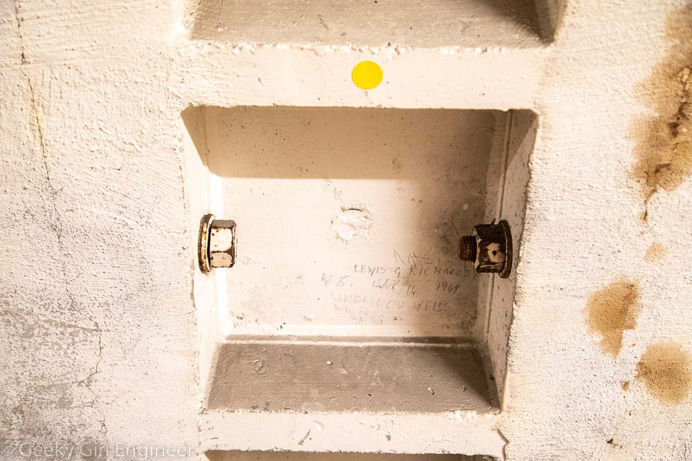
Graffiti on tunnel walls (the yellow dot sticker is there because the museum is a museum and now preserves the historical graffiti)

Reykjavik

I previously visited Reykjavik while on a two week visit to Iceland. I’m back for a short visit in hopes of seeing the aurora borealis. Thus far the weather and solar activity has not cooperated for that. Today I walked around a bit and took a few more photos.

In the middle of Reykjavik is a large pond, but in winter it is completely frozen over, except for a small corner. All the waterfowl are congregated in that area waiting on people to bring them bread. (On my Reykjavik post from 2014, there are photos of Tjörnin and the area in front of City Hall in May to compare how they look in winter and summer.)

Tjörnin (a pond or lake), which is almost completely frozen over

Birds congregating when people with food arrive

Swans came to determine if the reason I came to the water’s edge was to feed them

Monument to the Unknown Bureaucrat

The water in front of City Hall is completely frozen

Entrance to the Icelandic Punk Museum, which is located in a former public restroom

Vermont State Capitol

Today while on a New England trip, I continued on my quest to see all the state capitols and visited Vermont’s state capitol in Montpelier. The Vermont state capitol reminded me of the Alaska state capitol solely on its somewhat casualness and friendliness of people there. However, the Vermont state capitol is much prettier and ornate. Our tour guide was a now-retired state representative (because he didn’t run for reelection). I don’t know why I find it so funny that a state representative would be a tour guide when not representing, but I do. He was a wonderful tour guide though. The capitol is small really, but the rooms are lovely. The current capitol is the third state house. Probably by coincidence, the senate chamber is predominately green, and the house chamber is predominantly red. I noticed this because this is the exact opposite of a couple of state capitols such as California and Colorado, where the house is green based on the UK House of Commons, and the senate is red based on the UK House of Lords.

There are some neat details in the building. For example, the law dictates that the Vermont coat of arms must have five elements: a deer head, a cow, haystacks, pine tree, and mountains. However, the rest of the details are evidently up to interpretation, so our guide pointed out at least five different versions on the tour. A “bonus” detail we got to see because it not part of a the tour was a gorgeous fireplace in a lounge area that has all these different stones mined in Vermont. We got to see it simply because he was leading us to the elevator as a member of the group needed to use it. Something that I also found amusing is that the capitol does have a dome, but you can’t look into the interior as it is unfinished wood. Our guide pointed to the part of the ceiling that is below the dome at my request because I am weird.

Vermont State Capitol

Vermont House Chambers

Vermont Senate Chambers

Vermont Governor’s formal office

Ceiling in Vermont Governor’s formal office

Cedar Creek Reception Room

Vermont coat of arms on wall of House Chambers

Stairwell

Ceiling on first floor which blocks view of dome (also I think second floor also blocks view)

Hartford, Connecticut

I was in Hartford to see the Connecticut State Capitol, so while there I did a little wandering around. Hartford is like many older cities with a mix of old and new buildings. I rather like old cities that keep many of their older buildings. Not too long ago, Hartford reclaimed its connection to the Connecticut River, and now there is a nice riverwalk in some spots.

Old State House

Elevated walk near riverfront

Bulkeley Bridge over the Connecticut River

Hartford City Hall

Bushnell Park

Soldiers and Sailors Memorial Arch

Goodwin Square Tower

Grandview at New River Gorge National Park

Yesterday I went quite the hike within New River Gorge National park, and it was more of a hike that I thought it would be. I went to the Grandview area, and I hiked along the Grandview Rim trail. The trail is one way, so for the leg of the hike walking towards Turkey Spur, the end of the trail, I took the Castle Rock trail, which parallels the Rim trail for the first half mile. Castle Rock trail is gorgeous, and it takes you just below a wall of rock. At one portion of the trail, the wall of rock has a visible coal seam, which is extra interesting. However the footing on the Castle Rock trail is not even, and there is lots of ascents and descents, so it is a good workout. The rest of the trail, once back on the Rim trail is fairly easy going, especially compared to the Castle Rock trail. The start of the trail is the main overlook, which overlooks a bend in the New River, so you are viewing it from the base of a U shape. The end of the trail is Turkey Spur, which also overlooks the river, but at a location where in the foreground you see the river headed to the west, where it curves, then behind a hill, you can see the river looping around again and headed east.

Main overlook of New River

Castle Rock trail

Castle Rock trail

Rhododendron growing in coal seam along Castle Rock trail

Coal seam along Castle Rock trail

Grandview Rim trail

Turkey Spur overlook with Thomas Burford Pugh Memorial Bridge over New River in foreground and New River also in mid-ground

Turkey Spur overlook of New River

Rhododendron

Sandstone Falls

I left West Virginia today, but before leaving, I stopped at Sandstone Falls in New River Gorge National Park to do a little hiking. I also drove to a couple of overlooks of New River and Sandstone Falls.

Sandstone Falls

Sandstone Falls

Sandstone Falls loop trail

Sandstone Falls loop trail

Sandstone Falls loop trail view of New River

Pipevine Swallowtail Butterfly

New River overlook

Sandstone Falls overlook

New River Gorge National Park

I have been sightseeing and hiking in New River Gorge National Park and surrounding area for several days now. I will be posting the photos in a few different posts. I have taken quite a few photos in the area around the New River Gorge Bridge, so those are what I am posting now.

New River Gorge Bridge

View of New River from Canyon Rim Visitors Center outlook

New River Gorge Bridge

New River Gorge Bridge, view from Tunney Hunsaker Bridge

View from Tunney Hunsaker Bridge of New River

On Tunney Hunsaker Bridge with New River Gorge Bridge in background

New River between Tunney Hunsaker Bridge and New River Gorge Bridge

Jug Bay Wetlands Sanctuary

I went on a tour of Jug Bay Wetlands Sanctuary today, which sits along the Patuxent River on the east side. I have lived in the DC area for over a decade, and I am still discovering neat places to visit of which I just was not even aware exist. There are lovely forest and wetlands trails to see. Besides educational outreach, they also do scientific research on the wildlife and even archeology. It is a rather busy park really. On our tour, we also were able to go on a pontoon boat ride along the Patuxent River. There were so many red-winged blackbirds and ospreys along with lots of other birds that were difficult to see.

Jug Bay (in the morning while it was raining)

Spatterdock

Spatterdock flower

Jug Bay

Red-winged blackbird among the wetlands plants including cat-tails, wild ride, and spatterdock

Jug Bay Wetlands Sanctuary trail


Calvert Cliffs State Park

I visited Maryland’s Calvert Cliffs State Park today, which I have been wanting to do for a while. The park is known for its beach where you can fossil hunt for shell and shark teeth fossils among others. The hike to the beach is not quite two miles. What I didn’t realize until I got here, mainly because the state’s website gives only the barest of information and is very unhelpful, is how lovely the trails are. The trail that is the most direct path to the beach first passes through a lovely wooded area. It then goes alongside a wetland area, which currently is filled with blooming water lilies. The wetland area is gorgeous and worthy of a visit to the park all by itself.

The beach is small and not someplace I would go swimming, but it seems everyone goes to this particular beach to hunt for fossils, not to swim. I found the geology of the beach to be quite interesting. There were rocks and other objects along the beach of which I couldn’t understand the origin. I picked up a few shells and at least one fossil. However, I also picked up a couple of items that I still can’t determine what they are, even if they are natural or human-made objects. I took photos of the objects I collected. If anyone can help me understand what the objects are in the last photo (also featured in second to last photo), I would appreciate you leaving a comment.

Calvert Cliffs SP trail

Calvert Cliffs SP lily pond

Water lilies

Water lilies

Calvert Cliffs SP beach

Fossils, shells, and other objects from Calvert Cliffs SP

Objects of unknown origin from Calvert Cliffs SP